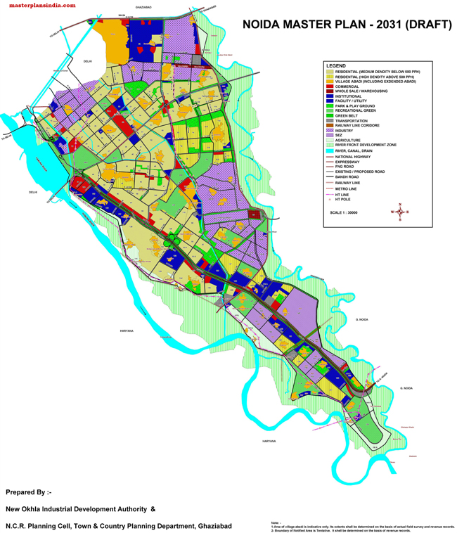
Noida Master Plan 2031 Map Draft contains the land use of different areas in the city.

Following are the proposed land uses in Noida Master Plan 2031
- Residential (Medium Density below 500 PPH)
- Residential (High Density above 500 PPH)
- Village Abadi (Including Exdended Abadi)
- Commercial
- Whole Sale / Warehousing
- Institutional
- Facility / Utility
- Park & Play Ground
- Recreational Green
- Green Belt
- Transportation
- Railway Line Corridor
- Industry
- SEZ
- Agriculture
- River Front Development Zone
- River, Canal, Drain
- National Highway Expressway
- FNG Road
- Existing / Proposed Road
- Bandh Road
- Railway Line
- Metro Line
- HT Line
- HT Pole
The master plan 2031 draft map is prepared by New Okhla Industrial Development Authority & and N.C.R. Planning Cell, Town & Country Planning Department, Ghaziabad.