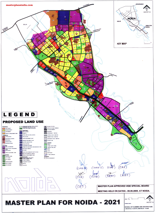
Master Plan Noida 2021 Map approved in special board meeting held on 09 September 2005, at Noida.

Below is the details of proposed land use in Noida Master Plan 2021
-
Residential
- Hi Density
- Medium Density
- Low Density
- Special Development Area
- Commercial
- Town Center
- Sub District Center
- Wholesale
- Warehousing
- Shopping Street
- Industrial
- Small and Medium
- Noida Export Processing Zone
- Film Center
- Special Economic Zone
- Recreational
- Regional Park
- City Parks
- City Forests
- Sports Center
- Golf Course
- Fair Ground
- Green Belt/Buffer/Social Forest/Nursery and Horticulture
- Trade and Exhibition Ground
- Public and Semi-Public
- Institutional
- Hospital
- Social and Cultural Center
- Fire Station
- Water Treatment Plant
- Sewage Treatment Plan
- Electric Sub-Station
- Police Station
- Telephone Exchange
- Cremation and Burial Ground Graveyard
- Religious Complex
- Colleges
- Education and Research Institute
- Hi-Tech Sanitary Land Fill
- Special Development Zone
- Transportation
- In-Land Container Depot/Steel Cement Yard
- Truck Terminal
- Transport Nagar
- Metro
- Helipad
- Railway Station
- Inter-State Bus Terminal
- City Bus Terminal
- Bus Depot
- Expressway – 75 Mt. Row
- Arterial Road – 60 Mt. Row
- Primary Road – 45 Mt. Row
- Secondary Road – 30- Mt. Row
- Railway Lines
- Miscellaneous
- Green
- Farms/Dairy farms
- Agriculture Land
- River
- Canal
- River Bund
- HT Line Corridor
- Boundary
- State Boundary