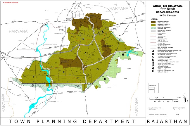
Greater Bhiwadi Urban Area 2031 map shows the boundaries of the urbanized area in 2009 and the area to be urbanized till 2031

Details of Bhiwadi Urban Area 2031 Map are
- Urbanised Area 2009
- Urbanisable Area 2031
- Peripheral Control Belt
- Planning Zone Boundary
- State Boundary
- Tehsile Boundary
- Village Boundary
- Muncipal Boundary
- Notified Area Boundary
- Dedicated Freight Corridor
- Bhiwadi -Kaharani-Chaupanki Industrial Zone
- Bhiwadi-Khijooriwas Planning Zone
- Khori-Kalan Planning Zone
- Khushkhera-Tapookara Industrial Zone
- Corporate Park Planning Zone
- Ecological Conservation Zone
Industrial property Work in Bhiwadi Face 1 2 3 Khushkhera Choonki Industrial land Sale Purchase & Rent